
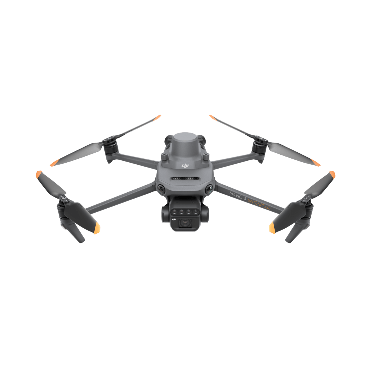
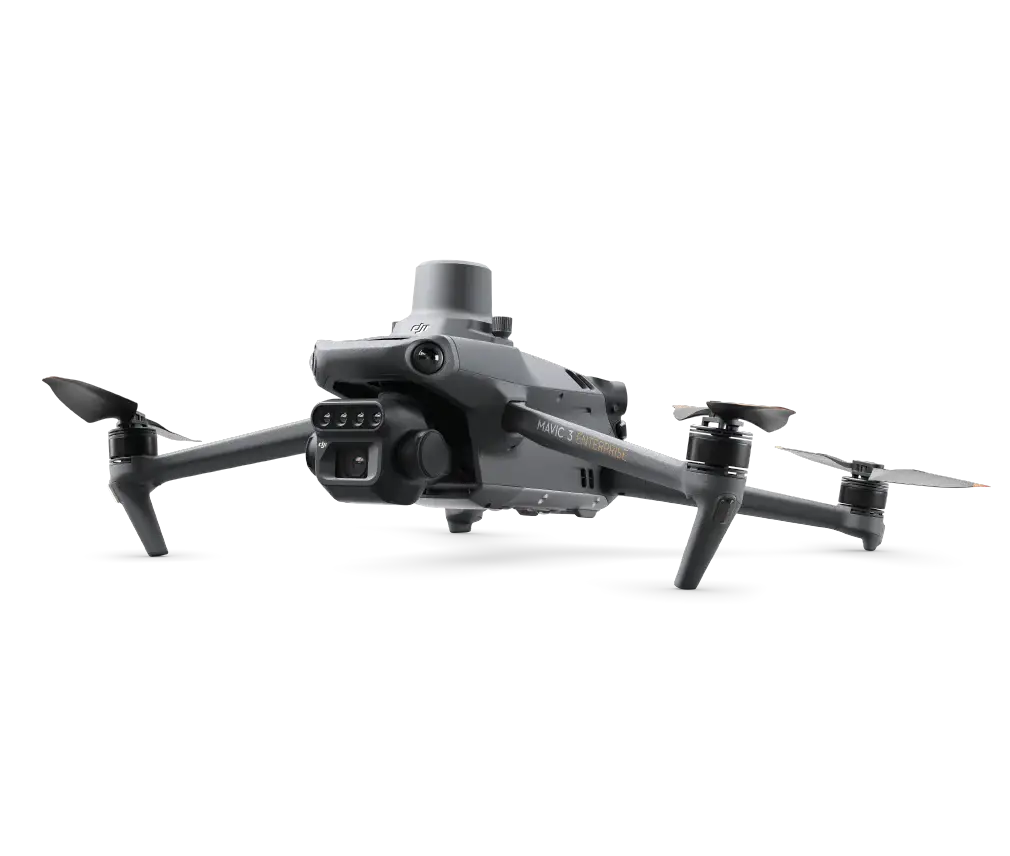
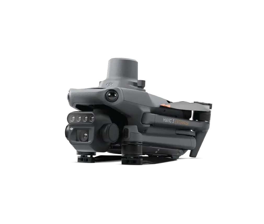
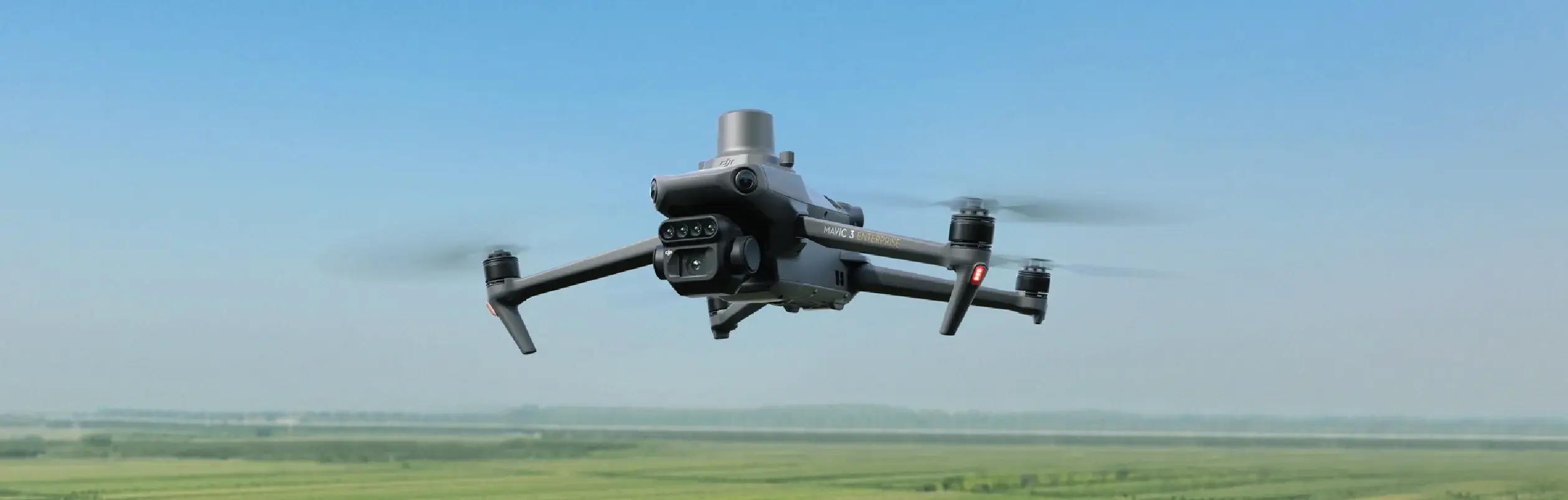
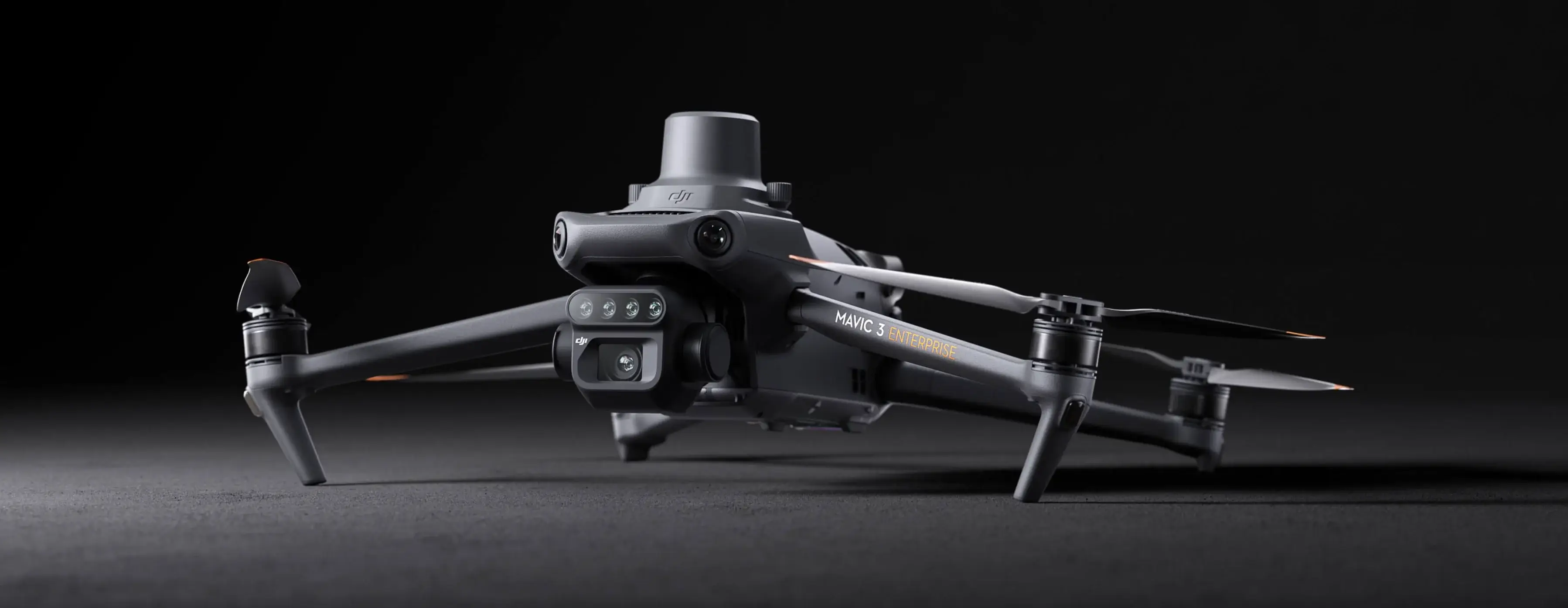
DJI Mavic 3M Multispectral
Drone Workflows
Precision operations start with better data. Mavic 3M combines a 20 MP RGB camera with four multispectral bands (G, R, Red Edge, NIR) plus RTK-grade positioning — then closes the loop by guiding agriculture drone spraying missions with actionable outputs for drone orchard spraying, drone vineyard spraying, and variable-rate drone fertilizer application across Ontario and the rest of Canada.
Three Field-Proven Workflows
Each workflow follows a “survey → analyze → plan → execute” loop, turning Mavic 3M data into measurable field action.
Orchard & Vineyard Mapping
3D reconstruction, fruit tree counting, and safer route planning for drone orchard spraying and drone vineyard spraying operations
Variable-Rate Application
NDVI maps → prescription files → automated drone fertilizer application with DJI Agras T50 and T100
Intelligent Field Scouting
Fast aerial coverage, centralized analysis, and one-person lifecycle monitoring
Orchard & Vineyard Mapping, 3D Reconstruction, Safer Route Planning
Mavic 3M supports terrain-follow aerial surveying for orchards and sloped landscapes. After a quick drone agriculture mission, DJI SmartFarm Web can perform cloud-based reconstruction, automatically count fruit trees, and generate intelligent flight routes that ag drones for spraying can follow — improving drone canopy penetration accuracy and reducing misses.
🍇 Vineyard note: This workflow is highly applicable to vineyard blocks, especially where elevation change, row structure, and obstacles increase operational risk. Accurate map-based route planning is one of the simplest ways to reduce misses, avoid collisions, and standardize results across crews for drone vineyard spraying.
Mavic 3M Aerial Surveying
Capture a clean, georeferenced dataset of the orchard or vineyard block — terrain variation, row structure, tree canopy geometry, and obstacles.
What Happens
- Run a planned mapping mission over the orchard block
- Terrain-follow maintains consistent height above ground on slopes
- Improves overlap consistency and reconstruction quality
Key Operator Focus
- Keep overlap high enough for reliable reconstruction and tree separation
- Midday or stable lighting reduces shadow artifacts
- Include headlands, row edges, and surrounding obstacles
- RTK usage improves absolute positioning and reduces stitching drift
Output
- RGB and multispectral images, geotagged, organized by mission
- Consistent dataset ready for photogrammetry or cloud mapping
Why this step matters: If your capture has gaps, low overlap, heavy motion blur, or inconsistent height, the map can still build — but tree counting and 3D route safety margins become less trustworthy.
DJI Terra / SmartFarm Web Mapping
Convert raw images into an operational map that a team can measure, plan, and share.
What Happens
- Software stitches images into an orthomosaic and 3D reconstruction outputs
- Orchard structure interpretation: separate tree canopy from non-tree objects
Key Operator Focus
- Choose the right mode: 2D for planning boundaries, 3D for height-aware routes
- Quality checks: look for warped rows, misaligned seams, missing strips, ghosting at edges
Output
- High-resolution orchard or vineyard block map
- Optional 3D surface outputs reflecting terrain and canopy structure
- Mapping layer supporting measurement, annotation, and export
Why this step matters: 3D route generation needs a reliable representation of terrain and obstacles — the reconstruction output enables height-aware routes instead of guesswork.
Generate 3D Routes
Turn the map into operation-ready flight routes that reduce risk and increase consistency for agricultural drones.
What Happens
- Platform uses mapped terrain and orchard structure to propose 3D operation routes
- Routes account for height changes and obstacle constraints
- Match block geometry, row direction, and operational preferences
Key Operator Focus
- Ensure adequate clearance from canopy tops, poles, wires, and perimeter obstacles
- Validate route direction and turn behavior at block edges
- Confirm routes maintain safe altitude across the steepest parts
Output
- Route files transferable to the operation environment for execution
- Standardized plan that crews can repeat, reducing dependence on individual pilot habits
Why this step matters: Vineyards often have strict row geometry, trellis structures, and edge obstacles. Good 3D routes reduce collision risk and produce more repeatable coverage patterns for safer, more consistent drone vineyard spraying.
Agricultural Drone Operation — Agras T50 / T100
Execute drone orchard spraying with fewer surprises, higher safety, and more uniform results using a DJI T50 spray drone or DJI T100 spray drone.
What Happens
- The DJI Agras T50 or Agras DJI T100 follows the prepared route plan as a precision drone sprayer
- Operators focus on mission supervision, refill logistics, and safety checks — the drone handles canopy penetration patterns automatically
Key Operator Focus
- Confirm the correct route, boundary, and safety clearance settings are loaded on the Agras
- Check temporary obstacles match the map (parked vehicles, new poles, seasonal wires)
- Post-flight: capture notes and update mapping layers if the block changed
Output
- Completed drone orchard spraying operation with higher repeatability
- Less manual steering burden — the DJI Agras T50 range and T100 payload capacity handle most blocks in fewer passes
Typical Operational Outputs
Guide Variable-Rate Applications
NDVI Maps → Prescription Files → Agras Execution
Whether the task is drone liquid fertilizer spraying on rice paddies, drone solid fertilizer application on cotton, or foliar drone nutrient delivery on potatoes, Mavic 3M captures multispectral imagery that can be processed into NDVI and other vegetation indices, then converted into prescription maps for variable-rate drone fertilizer application. DJI SmartFarm Web explicitly supports these agriculture drone spraying workflows, including NDVI-based zoning and prescription generation.
Mavic 3M Aerial Surveying (Multispectral)
Capture multispectral imagery that reflects crop vigor differences accurately, so indices like NDVI are meaningful.
What Happens
- Fly a multispectral mapping mission over the target field
- Multispectral bands capture plant reflectance patterns correlating with vigor, stress, and biomass
Key Operator Focus
- Consistency across dates: similar time of day, settings, overlap — makes trend comparison reliable
- Avoid patchy clouds and fast shadow movement that distort index maps
- Full coverage discipline — prescription maps must be continuous, missing strips become dead zones
Output
- Multispectral dataset, geotagged, ready for index generation
DJI SmartFarm Web Processing (NDVI & Indices)
Convert multispectral data into vegetation index maps that show spatial variability clearly.
What Happens
- Platform processes imagery and generates NDVI and other vegetation index maps
- Visualize variability zones: high vigor vs low vigor areas
Key Operator Focus
- Interpretation, not just visualization — pair index maps with agronomy context, soil zones, drainage, planting history
- Confirm the map is not dominated by bare soil, residue, or shadow artifacts
- Mark areas you already know have issues — confirm the map matches reality
Output
- NDVI and index map layers
- Visible variability zones that can be turned into a prescription
Generate Prescription Maps for Variable Rate
Convert variability into an actionable plan — rate by zone, rate by pixel, or rate by boundary segments.
What Happens
- Define management zones from the index map, assign application rates per zone
- System generates a prescription map for drone execution
Key Operator Focus
- Keep rates agronomically defensible and operationally executable
- Too many tiny zones cause over-fragmented application — smooth where needed
- Ensure boundaries align with actual field edges, avoid overlap spikes near turns
Output
- Prescription map file, compatible with variable-rate execution workflows
Agras T50 / T100 Variable-Rate Execution
Deliver precision drone nutrient delivery — apply drone liquid fertilizer or drone solid fertilizer where it generates the best return, reduce waste, and improve uniformity.
What Happens
- The DJI Agras T50 or DJI T100 drone runs the prescription map, adjusting drone fertilizer application rates automatically through zones
- Operators supervise safety and logistics while the drone sprayer handles rate transitions — supports both liquid and solid application modes
Key Operator Focus
- Confirm flow system calibration — verify rate changes behave as expected at zone boundaries
- Save as-applied records when available — enables auditing and improvement over time for every drone agriculture mission
Output
- Variable-rate drone fertilizer application completed with zone-level precision
- Repeatable data trail comparable to yield or scouting outcomes — proof for ag drones Canada compliance and reporting
Why Variable-Rate Matters
Intelligent Field Scouting
Fast Coverage · Centralized Analysis · One-Person Management
Mavic 3M can fly repeatable scouting routes as a routine drone agriculture mission and upload images into SmartFarm workflows for centralized review and analysis. DJI SmartFarm Web is positioned for lifecycle monitoring, including seedling detection, growth monitoring (NDVI and other indices), and yield estimation — giving every drone sprayer operator the field intelligence needed to make better decisions.
Goal
Replace scattered scouting notes with a repeatable aerial scouting loop — map-linked evidence and faster decision-making.
Key Focus
- Fly the same route weekly or biweekly — consistency makes change detection powerful
- Tag anomalies, generate “go-look points” for ground checks
Output
A scouting dataset tied to location, plus analysis layers and annotations that your team can share.
Typical Scouting Outcomes
Why High-Resolution Drone Maps Make “Smart Farming” Even Smarter
Multispectral drones are no longer only about maps. They are becoming data enginesfor modern AI. Foundation vision models like Meta's DINOv3 produce strong, reusable visual features — and drone-captured orthomosaics are typically much higher resolution than satellite imagery, making fine-grained tasks more tractable.
DINOv3: Tree Counting from Aerial Imagery
DINOv3 estimates the location of 7,064 agroforestry trees planted in January 2022 in Ashanti, Ghana by Eco-Care Ghana. World Resources Institute and the Bezos Earth Fund used DINOv3 to develop an algorithm to count individual trees using drone and satellite imagery.
Imagery © 2024 Maxar Technologies
Exceptional Performance Across Visual Domains
SSL (self-supervised learning) unlocks domains where annotations are scarce or costly. DINOv3 backbones enable state-of-the-art results for tasks including object detection in web imagery, and also canopy height mapping in satellite and aerial imagery.
How AI Plugs Into Each Workflow Step
After Step 1 — Capture
High-resolution drone orthomosaics are strong inputs for modern vision models — small details visible that satellites blur.
After Step 2 — Mapping
AI models help with tree counting, canopy segmentation, anomaly clustering, and change detection.
After Step 3 — Routes & Prescriptions
AI recommends zones and thresholds, then humans approve — a safer human-in-the-loop process.
After Step 4 — Execution
AI compares 'planned vs applied,' links results to yield and scouting outcomes for continuous improvement.
What This Means for Mavic 3M Workflows
Orchards & Vineyards
Variable Rate
Scouting
Long-term value: If you are building a long-term precision program, the value is compounding — every scouting flight becomes training data for better recommendations next month, and next season.
Frequently Asked Questions
What makes Mavic 3M different from a standard drone?
Mavic 3M combines a 20MP visible RGB camera with a dedicated four-band multispectral sensor (Green, Red, Red Edge, NIR) and RTK-grade positioning. This purpose-built design lets you capture both high-quality visual imagery and plant-health data in a single flight.
Can Mavic 3M data be used to plan DJI Agras spray routes?
Yes. Mavic 3M outputs processed through DJI Terra or SmartFarm Web can generate 3D route files, boundary maps, and prescription maps that can be used to guide Agras operations. This is the core of the 'survey → analyze → plan → execute' loop.
How does NDVI-based variable-rate spraying save money?
By applying more product in high-vigor zones and less in low-vigor zones, you match input to actual crop need. This reduces total chemical and fertilizer spend while improving yield uniformity — a measurable return that compounds over seasons.
Is Mavic 3M suitable for vineyard mapping?
Highly suitable. The terrain-follow capability handles the elevation changes typical of vineyard blocks, and the multispectral sensor captures canopy vigor data that row-by-row analysis can leverage for targeted treatment planning.
What is the role of RTK in these workflows?
RTK provides centimeter-level positioning accuracy. This means orthomosaic maps stitch more reliably, tree-counting algorithms have more consistent input, and downstream route files align precisely with actual field geometry.
How does AI fit into Mavic 3M workflows?
Foundation vision models like Meta's DINOv3 can process the high-resolution orthomosaics that Mavic 3M produces. Practical applications include automated tree counting, canopy segmentation, anomaly detection, and change tracking over time — all of which improve as your dataset grows.
What software do I need to process Mavic 3M data?
DJI Terra (desktop) and DJI SmartFarm Web (cloud) are the primary processing platforms. Terra handles orthomosaic and 3D reconstruction workflows, while SmartFarm Web supports NDVI analysis, prescription generation, and lifecycle monitoring.
Which DJI Agras drone should I pair with Mavic 3M for orchard spraying?
For most drone orchard spraying and drone vineyard spraying operations, either the DJI Agras T50 or the DJI T100 drone works well. The DJI T50 spray drone offers an excellent balance of payload, DJI Agras T50 range, and manoeuvrability for mid-size blocks, while the Agras DJI T100 is built for large-scale agriculture drone spraying with higher throughput and wider swath coverage.
Can I use these workflows for drone fertilizer application, not just pest spraying?
Absolutely. Workflow 2 is specifically designed around variable-rate drone fertilizer application. It supports both drone liquid fertilizer (foliar sprays, liquid nitrogen) and drone solid fertilizer application (granular urea, potash) via the DJI Agras T50 or T100 spreading system. The prescription maps ensure optimal drone nutrient delivery rates per zone.
Is SkyFlow available for drone agriculture in Ontario?
Yes. SkyFlow provides drone agriculture Ontario services and supports ag drones Canada-wide. Our team helps growers configure complete Mavic 3M + Agras workflows — from initial aerial surveying through variable-rate execution — tailored to Ontario growing conditions, crop types, and regulatory requirements.
Sources & References
Ready to Build Your Precision Mapping Program?
Whether you need an agricultural drone quote for a DJI Agras T50, a DJI T100 drone, or a complete Mavic 3M sensing package — talk to a SkyFlow application engineer. We provide Ontario drone services and support ag drones Canada-wide, from scoping your fields to configuring a full survey-to-action loop.