AI-Powered Drone Inspection
Smarter Scans. Safer Operations.
Fewer shutdowns start with smarter scans. SkyFlow turns risky climbs and guesswork into precise, geotagged insight — RGB + thermal imagery, orthomosaic maps, and engineer-ready defect callouts — delivered fast and safely. From roofs and facades to roads, bridges, and PV arrays, we help you spot problems early, prioritize fixes, and keep operations moving — no rope access, no lane closures, no blind spots.
Survey & Mapping Capabilities
Our team performs conventional 2D, 3D, and orthomosaic surveys. Using RTK poles for ground control points, we achieve survey-grade accuracy with compliance for ASPRS, ISO 19157, and CSA S250 where relevant.
Connections & Balance of System
Layout & Shading Assessment
Standards & Compliance
Solar Photovoltaic Inspection
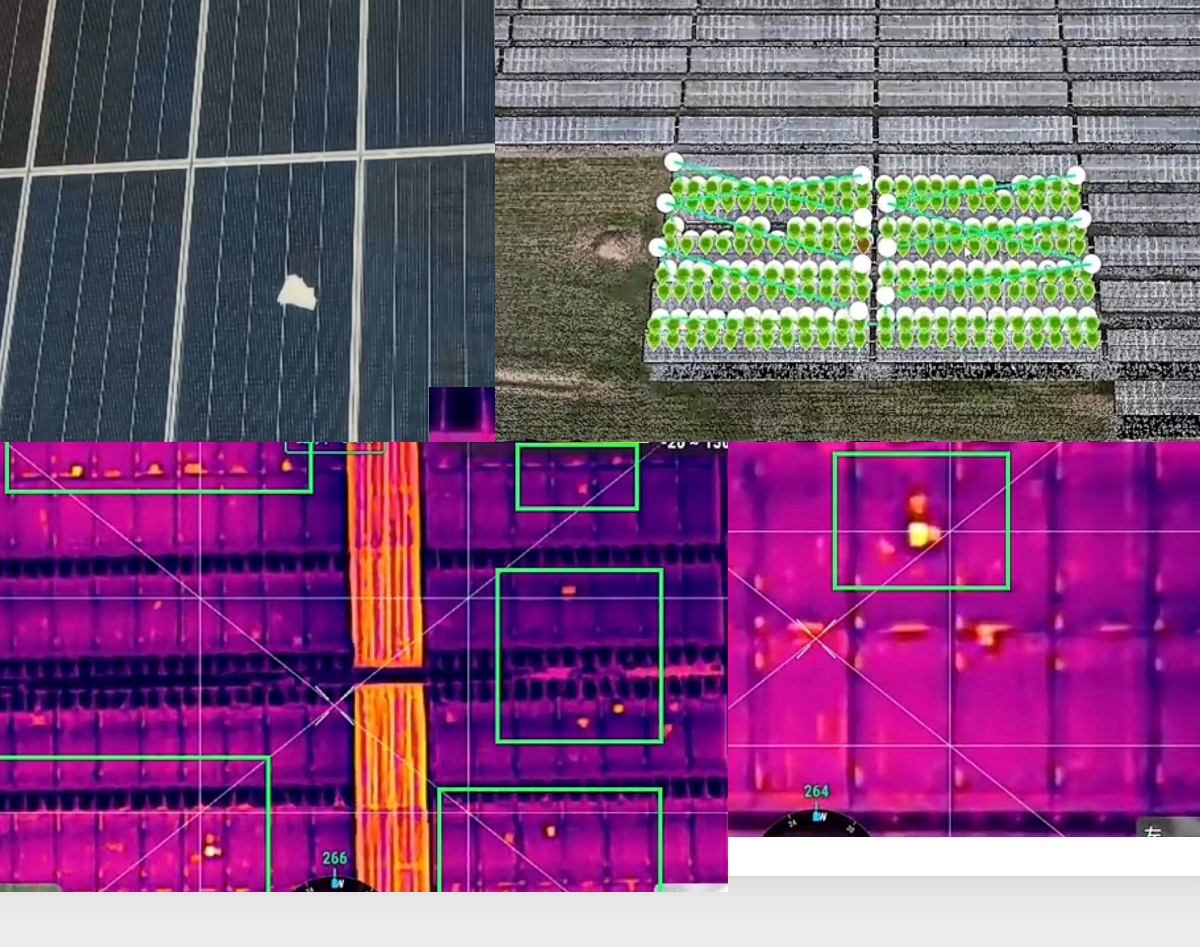
Thermal infrared imaging combined with AI-powered analysis identifies hotspots, bypass diode faults, and mechanical damage across entire PV arrays in a fraction of the time manual inspection requires.
Electrical Anomalies
Mechanical & Optical
AI-Enhanced Detection: Modern deep learning models like HOTSPOT-YOLO achieve over 90% mean average precision for detecting small thermal anomalies in PV arrays, while maintaining real-time performance during flight. Combined with SegFormer-based segmentation for snail trail and hotspot identification, our processing pipeline delivers comprehensive defect reports that integrate directly into maintenance workflows.
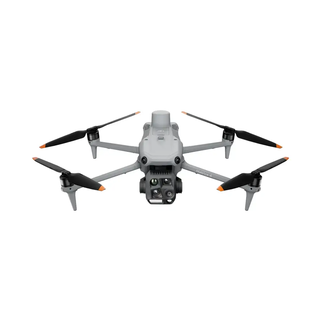
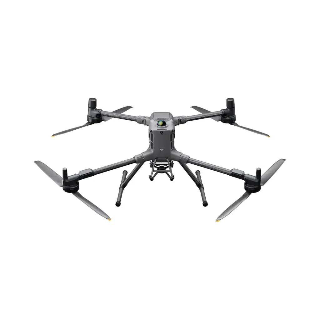
DJI Matrice 4T
Thermal + zoom enterprise platform for large-scale PV array inspection with radiometric IR.

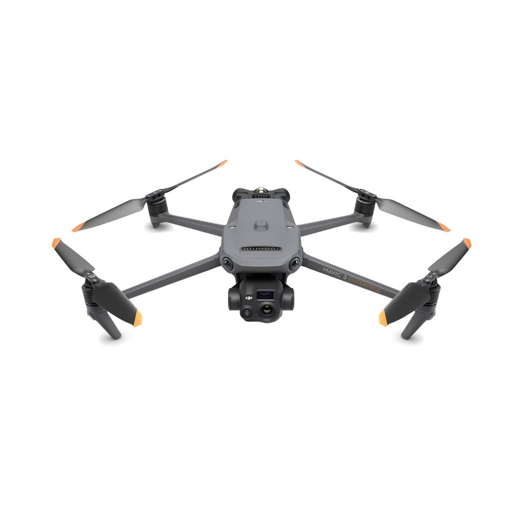
DJI Mavic 3T Thermal
Compact thermal drone for smaller PV sites and rapid rooftop solar scans.
DJI Mavic 3TA Thermal Advanced
Advanced thermal imaging with higher resolution IR sensor for detailed PV cell-level anomaly detection.
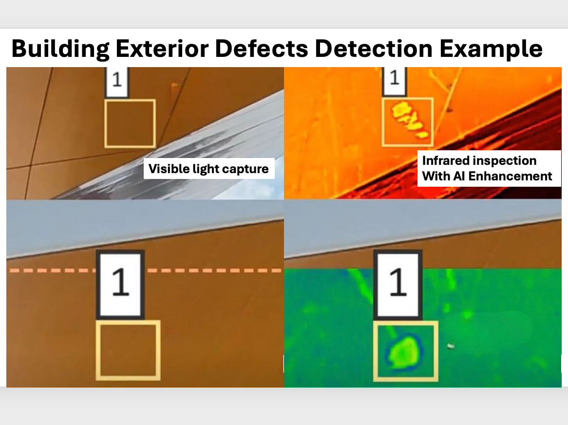
Building & Facade Inspection
Detect exterior defects, thermal bridging, moisture intrusion, and insulation failures on building facades and rooftops — visible and infrared, side by side, with AI-enhanced defect callouts.
Why Drones Replace Rope Access
What We Detect
Consistency at Scale: AI applies identical analysis logic to every image — eliminating inspector bias and inconsistent severity ratings. Findings integrate directly into maintenance workflows, enabling engineers to track deterioration progression across inspection cycles and support budget decisions with reliable, repeatable data.
DJI Mavic 3TA Thermal Advanced
Advanced thermal with high-res IR — ideal for detailed facade thermal bridging and moisture detection.
DJI Mavic 3T Enterprise
Compact thermal enterprise drone for rapid building surveys and tight urban environments.
DJI Matrice 400
Heavy-lift enterprise platform with interchangeable payloads for complex multi-sensor facade inspections.
Infrastructure Integrity Scan
Detect cracks, rust, corrosion, and insulation damage on roads, bridges, and structures using advanced AI algorithms and comprehensive reporting — including full 3D models with geo-referenced defect overlays.
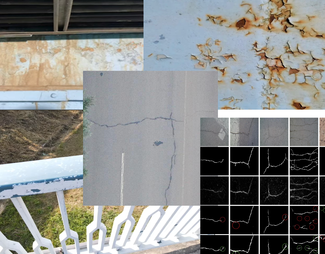
AI Detection Capabilities
DJI Matrice 4T
Thermal + high-zoom for bridge decks, structural elements, and hidden insulation defects.
DJI Matrice 400
Heavy-lift platform with interchangeable payloads — LiDAR, zoom, and thermal for complex infrastructure.
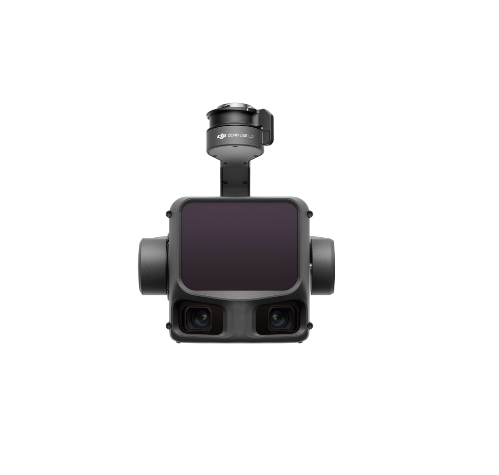
Zenmuse L3 LiDAR
LiDAR point cloud for precise 3D structural models and volumetric deformation tracking.
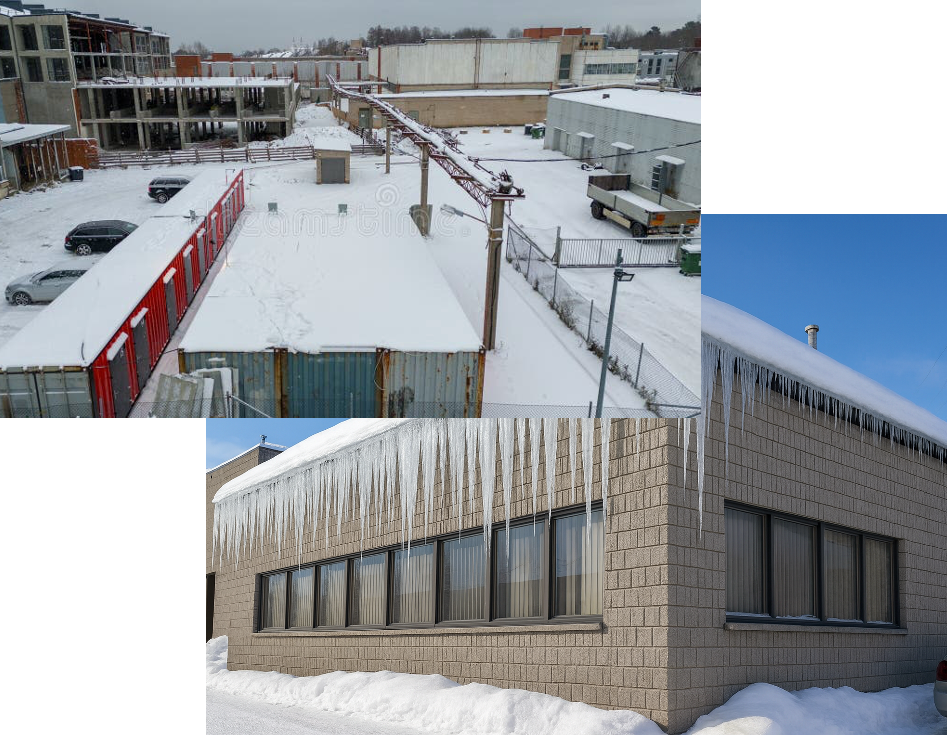
Snow & Ice Risk Assessment + De-Icing
Hard-to-reach large rooftops need de-icing and snow removal? No problem — we fly on top to get you covered. Combine aerial assessment with drone-applied de-icing agents for a complete winter risk management solution.
- Snow-coverage mapping for parking lots and campuses
- Salt and sand stockpile volumetrics
- Post-storm documentation and condition reports
- Sidewalk and ADA route accessibility checks
- Drainage and ponding risk mapping
- Solar-farm snow coverage assessment
- Tree and line encroachment along roads
- Spread snow/ice removal agents via spray drones
- Large commercial rooftops — no crew on the roof
- Targeted application reduces chemical waste
- Icicle and ice dam prevention on eaves
- Repeat treatments on automated schedules
- Real-time thermal monitoring of ice formation
- Post-treatment verification flyover
DJI Matrice 400
Multi-payload platform — swap between thermal, zoom, and LiDAR for comprehensive winter site assessment.
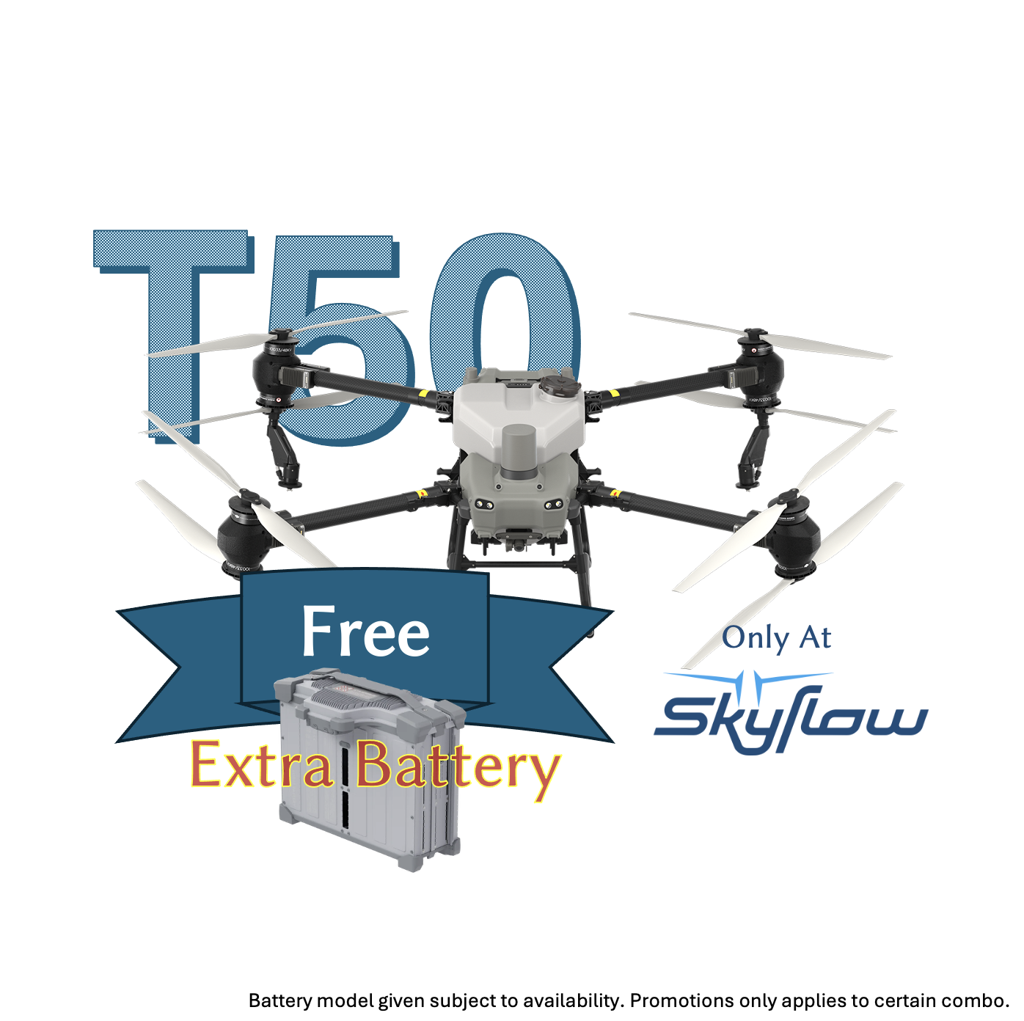
DJI Agras T50
Compact 40L spray drone for targeted de-icing on smaller rooftops and precision applications.
DJI Mavic 3T Thermal
Rapid thermal surveys for snow-load mapping, ice detection, and post-treatment verification.
Platform Selection Guide
Choosing the right drone depends on the inspection scope, asset type, and deliverable requirements.
| Use Case | Matrice 4T Thermal + Zoom | Mavic 3T Compact Thermal | Matrice 400 Multi-Payload Platform |
|---|---|---|---|
| Solar PV Thermal | Ideal | Good | Ideal (H30T payload) |
| Building Facade | Ideal | Good | Ideal (swap payloads per pass) |
| Bridge / Road | Ideal | Good | Ideal (LiDAR + thermal) |
| 3D Structural Model | Ideal | Good | Ideal (Zenmuse L3 LiDAR) |
| Snow Coverage Survey | Good | Ideal | Good |
| Volumetric Stockpile | Good | Good | Ideal (LiDAR precision) |
| Multi-Sensor Mission | Fixed payload | Fixed payload | Swap thermal, zoom, LiDAR |
| Flight Endurance | 42 min | 45 min | 42 min (no payload) |
Matrice 400 — Multi-Payload Advantage: Unlike fixed-payload platforms, the M400 lets you swap between Zenmuse H30T (thermal + zoom + rangefinder), Zenmuse L3 (LiDAR), and other payloads between flights on the same airframe. One platform covers thermal inspection, high-res visual surveys, and 3D point cloud generation — reducing fleet costs and simplifying crew training across all inspection types.
What You Receive
Every inspection produces actionable, engineer-ready deliverables — not just raw footage.
Frequently Asked Questions
How accurate are drone inspection measurements?
Using RTK ground control points, we achieve horizontal accuracy of ±2–3 cm and vertical accuracy of ±3–5 cm. This meets ASPRS positional accuracy standards and is sufficient for engineering-grade assessments, structural monitoring, and compliance reporting.
Can drone thermal imaging detect problems inside walls or under surfaces?
Thermal cameras detect surface temperature differentials caused by subsurface issues — such as moisture behind cladding, insulation voids, or delamination in concrete. While they do not image through materials directly, the thermal contrast reveals hidden problems that are invisible to the naked eye.
How does AI improve inspection accuracy compared to manual review?
AI applies consistent detection logic across every image, eliminating inspector fatigue and subjective severity ratings. Modern models achieve over 90% recall for thermal anomalies in PV arrays and can automatically classify crack widths, corrosion extent, and spalling severity — producing reports in hours instead of days.
What size of solar farm can you inspect in one day?
With a Matrice 4T running automated waypoint missions, a single crew can inspect 200–500+ acres of PV panels per day depending on site layout and flight conditions. Each defect is automatically geotagged and classified for immediate maintenance prioritization.
Can drones actually spread de-icing agents on rooftops?
Yes. Spray drones like the DJI Agras T50 with a 40L tank can spread liquid or granular de-icing agents across commercial rooftops. This eliminates the need for crews to work on icy, elevated surfaces — reducing both risk and labor costs while providing more uniform coverage than manual application.
What regulations apply to inspection drone operations in Canada?
Commercial drone inspections in Canada require compliance with Transport Canada's Canadian Aviation Regulations (CARs Part IX). Depending on site and airspace, operations may fall under Basic, Advanced, or SORA/SAIL-based approvals. SkyFlow ensures all operations meet current regulatory requirements including the 2025 Standard 922 framework.
Do you provide the raw data or just reports?
Both. Every project includes engineer-ready reports with annotated defects, severity ratings, and priority matrices. You also receive all raw imagery, thermal data, and 3D models for your own analysis or integration into existing asset management systems.
Sources & References
Ready to Inspect Smarter?
Talk to a SkyFlow inspection specialist. We will help you scope your project, select the right platform, and deliver actionable insight — faster and safer than traditional methods.