
About a 12-minute read
Whether you are new to drone surveying or you are a professional focused on urban renewal, one of the most challenging tasks is inspecting aging buildings for structural defects. This article covers the most common defects found in older buildings during urban renewal projects (wall cracking, facade spalling, roof leaks, structural deformation, window and door damage, and more) and walks through the complete drone surveying workflow from "pre-flight planning to field operations to data processing to final deliverables." Let's dive in.
Pre-Flight Planning: AI-Assisted Preparation for Aging Building Defect Surveys
Given the unique characteristics of aging buildings and older neighbourhoods, it is critical to clearly define the defect survey requirements before flying. This step prevents rework and ensures nothing gets missed. AI plays a supporting role here: "assisted planning and early prediction", reducing human planning errors and workload.
1. Key Workflow Steps
(1) Define the task requirements: Survey area: The specific boundaries of the aging neighbourhood (for example, a block of 10 older residential buildings including surrounding structures). Accuracy requirements: Centimetre-level precision is needed (to capture wall cracks, facade spalling, and other fine defects, with error no greater than 5 cm). Defect survey priorities: Clearly identify the common aging building defects to capture (wall cracking, facade spalling, evidence of roof leaks, parapet deformation, window/door damage, roof membrane deterioration, etc.).
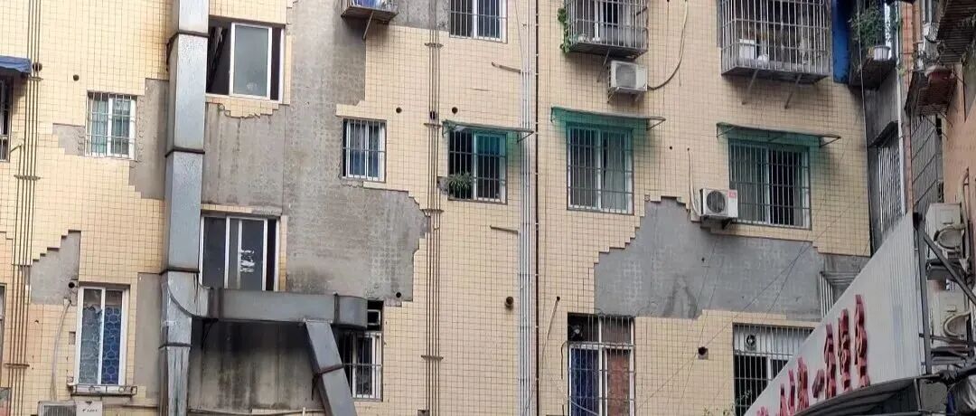
(2) Data collection and site survey: Gather baseline information on the target buildings (construction date, structural type, previous defect records). Conduct a site visit to assess the neighbourhood environment. Older neighbourhoods often have tightly spaced buildings, narrow gaps between structures, and overhead wires and trees creating obstructions. Mark these obstructed zones in advance. Check weather conditions and airspace (older neighbourhoods in Canadian cities are often near airports, heliports, or controlled airspace zones). Confirm calm, dry conditions for the flight day. Rain obscures defects and wind creates drone control risks.
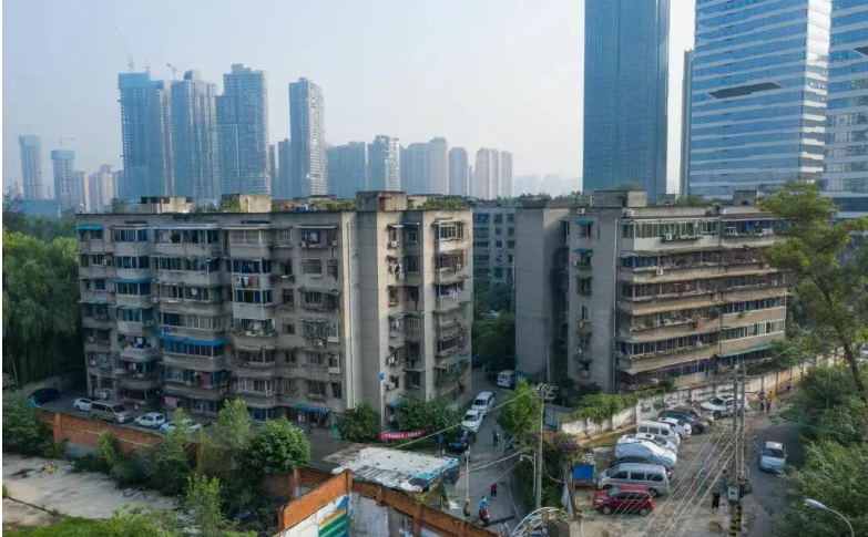
Using AI image analysis tools, import previous satellite or aerial imagery of the area. The system can automatically identify building layouts, overhead wires, trees, and other obstructions, quickly flagging flight hazard zones to assist manual flight path planning. This reduces the on-site survey workload, especially useful for large older neighbourhoods with many buildings spread across a wide area.
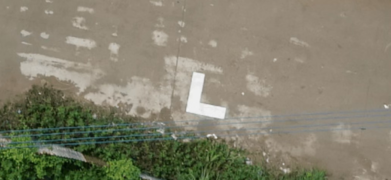
(3) Ground control point (GCP) placement: Because fine defect capture requires high accuracy, GCP placement is mandatory. Place them in open areas (such as courtyards or wide gaps between buildings) and on building rooftops at edges (unobstructed, easily visible to the drone). Use white targets or custom cross-pattern targets. Avoid placing them on defect areas (to prevent obscuring defects or interfering with identification). Follow up with RTK measurements for coordinates, which serve as the baseline for defect positioning and size measurement.
(4) Mission planning: Prioritize compact drones like the DJI Mavic 3 Enterprise, which is well suited for navigating narrow gaps between buildings. Pair it with a high-resolution oblique camera that captures walls and roofs from multiple angles to detect facade defects. Plan flight paths: use oblique flight mode for building facades (multi-angle capture to avoid missing defects on side walls) and nadir (straight-down) flight mode for rooftops (full coverage for detecting leaks and membrane deterioration). Set flight altitude between 5 and 15 metres (adjusted based on building height to clearly capture cracks, spalling, and other fine defects). Forward overlap of 85% or more, side overlap of 70% or more (to ensure no defect details are missed). Assign clear team roles (drone pilot, defect observer, data recorder).
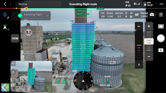
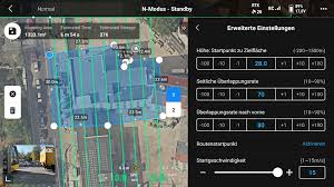
Using AI flight planning software, import building coordinates and priority defect survey zones. The system automatically generates optimal flight paths, adjusting altitude and angle based on AI-predicted obstructions to avoid missing defect areas while reducing manual planning time. This is especially valuable in densely built, complex older neighbourhoods.
2. Recommended Hardware and Software
(1) Hardware: GCP targets (custom cross-pattern targets for centimetre-level accuracy), RTK units (for GCP coordinate measurement), compact drones (DJI Mavic 3 Enterprise, DJI Phantom 4 RTK, nimble enough to navigate between buildings), high-resolution oblique camera (DJI P1 for capturing facade defect details), laptop (for flight planning and reviewing building records).
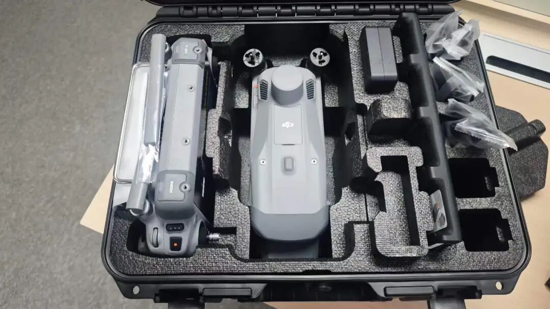
(2) Software: Standard software: Airspace authorization platform (in Canada, file through NAV CANADA's drone flight authorization system or use the NRC Digital Sky platform for controlled airspace requests), flight control software (DJI GS Pro for precise oblique flight path planning suited to dense building environments), mapping software (ArcGIS, Global Mapper for reviewing building layouts and assisting with flight planning).
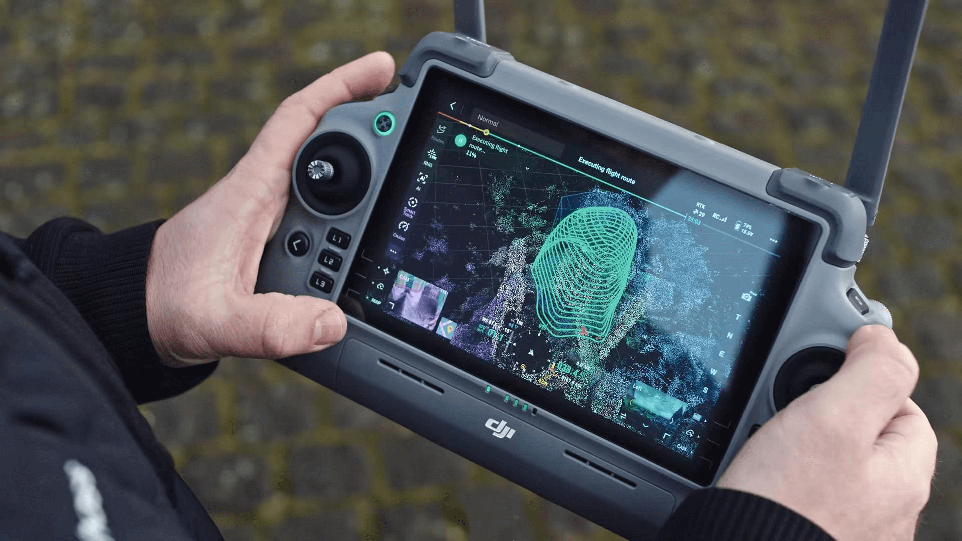
AI-assisted software: DJI Terra (built-in AI flight planning and obstruction identification, beginner-friendly), Pix4D or similar AI-enabled flight planning systems (automated defect survey flight path generation suited to older neighbourhoods).
3. Important Notes
(1) Don't skip airspace authorization: Older neighbourhoods are often in urban cores, near residential areas, schools, and major roads. In Canada, flights in controlled airspace require authorization through NAV CANADA or the applicable provincial process. Submit requests 1 to 3 days in advance, confirm approval before flying, and avoid delays to the survey schedule.
(2) Don't place GCPs on defect areas: Avoid having targets obscure wall cracks, spalling, or other defects. Also avoid shadow zones and areas blocked by overhead wires to ensure the drone can clearly capture the targets. Otherwise, defect positioning accuracy will suffer.
(3) Survey flight hazards in advance: Older neighbourhoods often have messy wiring, dense tree canopy, and narrow building gaps. Before flying, mark wire and tree locations. Plan routes around these obstacles to prevent the drone from hitting wires or trees. Also avoid flying close to residents' windows to reduce safety risks.
After AI-assisted planning, always conduct a manual review to catch any AI misidentifications (for example, mistaking balcony items for structural obstructions).
Field Operations: Precise Capture of Aging Building Defects
Unlike routine aerial surveys, building defect flights must focus on facade and rooftop details, avoiding missed fine cracks or localized spalling. Flight safety is equally important. AI can provide "real-time monitoring and anomaly alerts" to assist human operators with capture quality control, reducing missed or blurry shots.
1. Key Workflow Steps
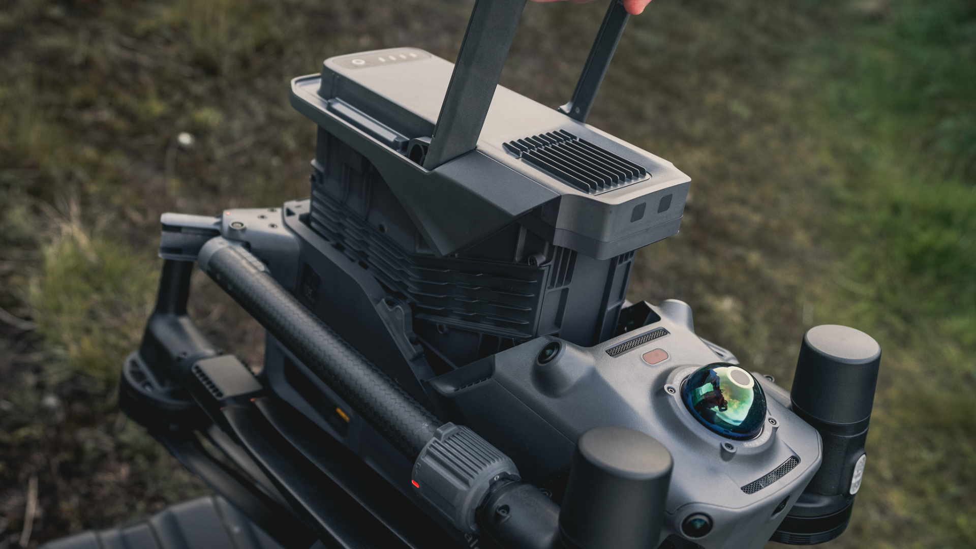
(1) Equipment check: Before flight, check the drone's battery level (bring 3 to 4 spares since oblique flights in tight spaces drain batteries quickly), oblique camera settings (adjust focus and exposure to clearly capture wall cracks as small as 1 mm), controller signal and RTK module (ensure accurate positioning for defect coordinate tagging), and compass calibration (prevent the drone from drifting between buildings). Critically, check that the camera lens is clean. A dirty lens produces blurry images that can miss defects.
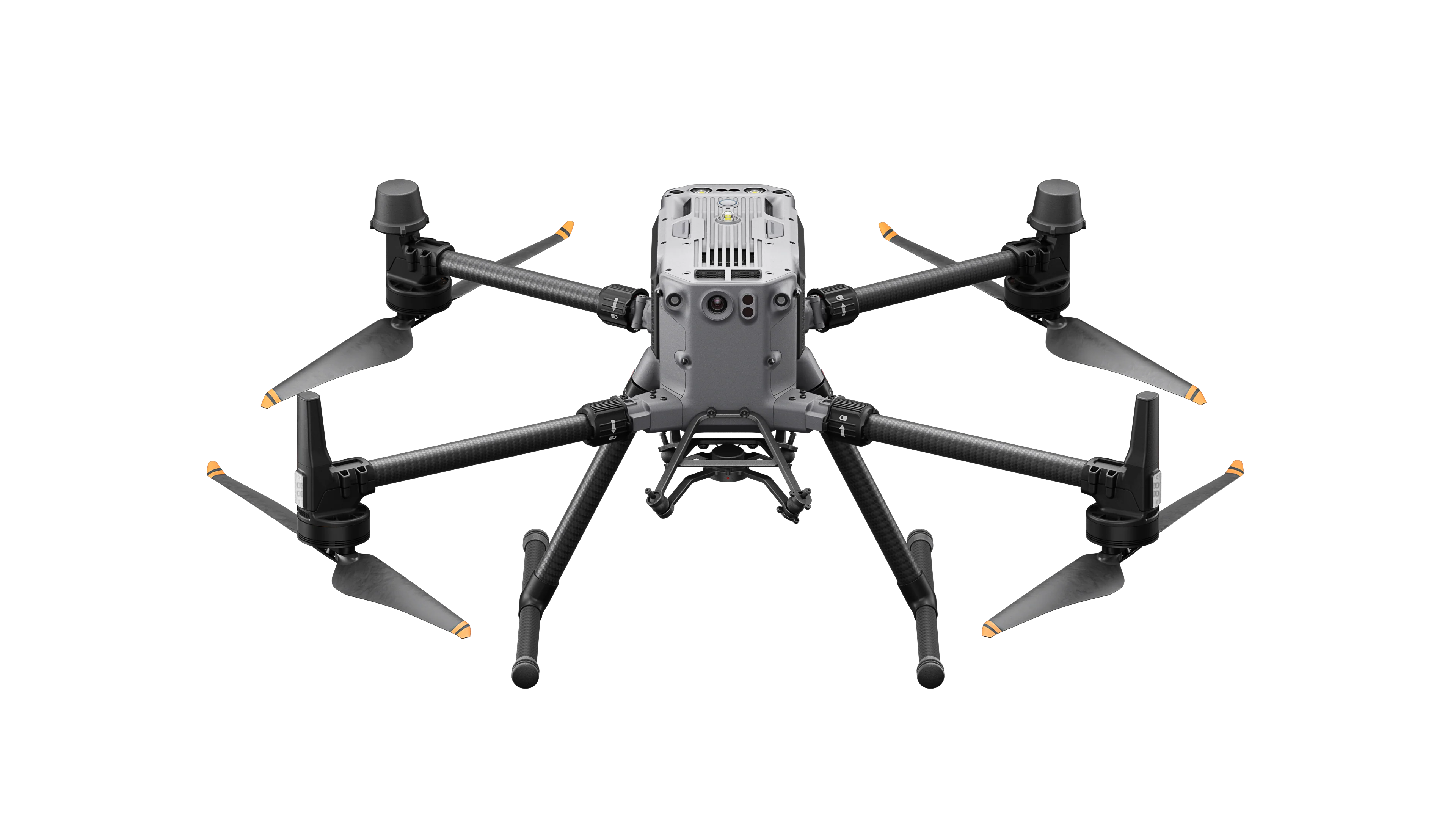
(2) Detailed flight path planning: In the flight control software, precisely define each building's boundary and plan routes per building. For example: Building facades: Use oblique flight mode, capturing front, side, and rear angles (at least 3 angles per building). Match flight altitude to building height (5 to 10 metres for low-rise, 10 to 15 metres for mid-rise) to ensure every section of wall is captured. Focus on wall corners, window sills, and parapets where defects are most likely to appear.
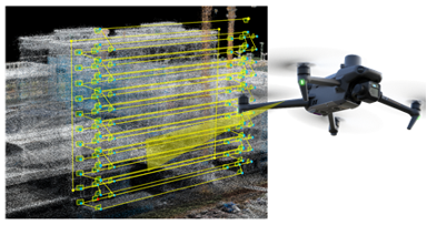
Building rooftops: Use nadir flight mode for full coverage, focusing on roof membranes and drain outlets (areas prone to leaks). Ancillary structures: For aging perimeter walls, stairwells, and ground-level parking structures, plan separate flight paths to capture their defects (such as wall cracking or stairwell facade spalling).
Some professional flight control tools (like DJI GS Pro) include AI defect pre-identification features that analyze imagery in real time during flight. If suspected defects (such as wall cracks or spalling) are spotted, the system alerts the operator to pause and capture close-up supplementary shots, avoiding missed fine defects. AI also monitors the flight path in real time, warning if the drone drifts from the planned route or approaches obstacles (wires, trees), reducing safety risks.
(3) Automated flight and image capture: Once configured, the drone flies the planned route automatically while the operator monitors. Focus on image clarity (confirm that fine cracks are visible) and defect coverage (if a significant crack is noticed on a wall, manually pause the drone for close-up supplementary capture). Avoid overhead wires, trees, and residents' windows to ensure safe flight and prevent the drone from damaging aging buildings or injuring people.
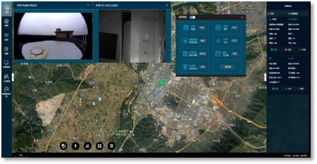
AI screens captured images in real time, automatically discarding blurry, overexposed, or underexposed photos while flagging images that appear to contain defects, reducing the post-processing screening workload. In areas with insufficient light or heavy glare, AI automatically adjusts camera exposure parameters to maintain image clarity, especially useful in overcast or late-afternoon low-light conditions.
(4) Field data review: Immediately after the flight, review photos on-site. Clarity: Confirm every image clearly shows defect details (such as crack width, spalling area). Re-shoot any blurry or overexposed images immediately. Coverage: Confirm every building's facade and rooftop, and every defect-prone area, has been captured with no gaps. Data completeness: Confirm photos, POS data (for defect positioning), and GCP capture (confirm all control points appear in imagery). Only leave the site once everything checks out, avoiding situations where missing data prevents accurate defect positioning later.
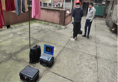
Using AI data review tools, teams can quickly batch-check image clarity and coverage, automatically flagging missed areas and blurry photos to assist human operators in completing field data review. This improves efficiency (manual review of one neighbourhood takes 30 minutes; AI-assisted review takes about 10 minutes).
2. Recommended Hardware and Software
(1) Hardware: Drones (DJI Mavic 3 Enterprise, DJI Phantom 4 RTK, compact and agile for tight building environments, some models support AI real-time monitoring), oblique cameras (DJI P1 oblique version for high-resolution fine defect capture), spare batteries, controller, RTK base station (for improved positioning accuracy), lens cleaning kit (keep the lens clean to maintain image quality).
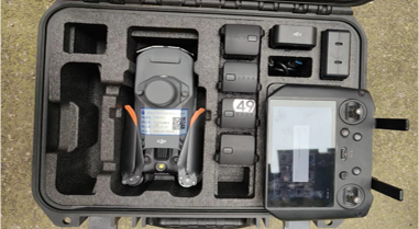
(2) Software: Flight control software (DJI GS Pro for precise oblique flight planning with manual supplementary capture support), photo review software (Adobe Lightroom for quickly checking image clarity and assessing defect capture quality).
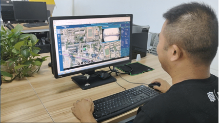
AI-assisted software: DJI Terra (AI real-time defect pre-identification, photo screening), AI flight control assistants (obstacle warnings, route deviation alerts), AI data checking tools (batch image quality verification).
3. Important Notes
(1) Don't fly too high or too low: Too high and defect details become blurry. Too low and you risk hitting buildings or wires. Adjust precisely based on building height: 5 to 10 metres for low-rise, 10 to 15 metres for mid-rise. Ensure detail clarity while maintaining safe flight.
(2) Don't miss fine defects: Wall cracks, minor roof leak stains, and other subtle defects are easy to overlook. Increase overlap (forward 85%+, side 70%+) and manually supplement critical areas (wall corners, window sills). AI pre-identification is a helpful aid, but do not rely on it entirely. Human operators must actively watch for fine defects.
(3) Safety first on site: Operators should stand in open, safe areas of the neighbourhood, well away from wires and building edges. Avoid flying over areas where residents are gathered. If conditions change suddenly (strong wind, signal loss), activate the return-to-home function immediately to prevent the drone from falling onto aging buildings and causing further damage.
Data Processing: Precise Modelling and Defect Annotation
After field operations, the next step is software processing: turning photos into 3D models and orthomosaic imagery, precisely annotating defect locations, dimensions, and types to support repair planning. This is where survey results become actionable. AI's role is primarily to solve the problem of "tedious manual annotation, low efficiency, and missed or misidentified defects", improving annotation accuracy.
1. Key Workflow Steps
(1) Data import and screening: Import field photos, POS data, and GCP coordinates into processing software. Screen photos carefully: discard blurry, overexposed, or underexposed images (these cannot reliably show defects). Keep images that clearly display defect details (cracks, spalling, leak stains). Verify POS data, removing records with signal interruptions or anomalies, ensuring every defect photo has accurate position data. Organize GCP coordinates and standardize the coordinate system (matching the project's required datum, such as NAD83 commonly used in Canadian surveying), for consistent defect positioning.
AI can automatically screen photos, using algorithms to identify and discard blurry, overexposed, or underexposed images while retaining clear defect photos. Batch processing efficiency is 5 to 10 times faster than manual screening. Some AI tools automatically cross-reference POS data with photos, flagging anomalies to reduce manual verification effort and errors.
(2) Aerial triangulation (ensuring accurate defect positioning): This is a critical step. Using software like Pix4D or ContextCapture, the system automatically identifies tie points across photos, builds an aerial triangulation network, and incorporates GCP coordinates for adjustment calibration to ensure 3D model and orthomosaic accuracy (error within 5 cm). This provides the baseline for accurate defect positioning and size measurement. Focus on ensuring precise coordinates for building facades and rooftops to avoid defect location errors.
AI optimizes the aerial triangulation algorithm, automatically identifying tie points. This is especially valuable for complex older neighbourhood environments (dense buildings, many obstructions), reducing tie point matching failures and shortening processing time (a medium-sized neighbourhood that takes 8 hours with manual assistance can be completed in 3 to 4 hours with AI optimization). AI also automatically checks triangulation accuracy, alerting operators to adjust parameters or re-screen photos if accuracy falls short.
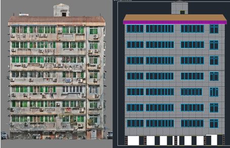
(3) 3D modelling and data generation: After aerial triangulation, generate high-density 3D point clouds and 3D models that clearly reproduce building facade and rooftop details. Produce DOM (digital orthomosaic for 2D defect annotation) and DSM (digital surface model for assessing roof deformation). Focus on optimizing model details to ensure fine defects like wall cracks and spalling are clearly visible in the model for subsequent annotation. AI refines the modelling process, automatically enhancing defect area detail and restoring wall and roof features, preventing model blur that would make defects unidentifiable. Some AI-enabled modelling software can automatically identify building outlines and defect zones, pre-marking suspected defect locations as a reference for annotation.
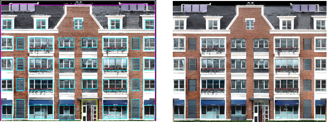
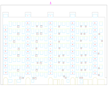
(4) Data editing and defect annotation: On the 3D model and orthomosaic, annotate building defects. Tag defect types (wall cracking, facade spalling, roof leaks, structural deformation, etc.). Measure defect dimensions (crack length and width, spalling area, deformation extent). Mark defect positions (precise coordinates for field verification). Classify defect severity (for example, cracks 2 mm or narrower as minor, 2 to 5 mm as moderate, 5 mm or wider as severe), providing a basis for repair prioritization. Also correct blurry model boundaries and fill in any missed defect details.
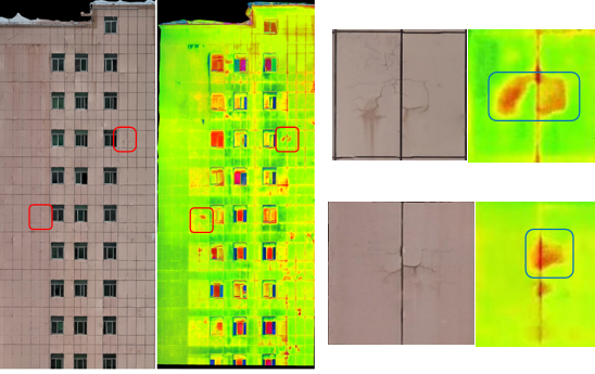
AI defect auto-annotation tools use deep learning algorithms to automatically identify wall cracks, facade spalling, roof leaks, and other common defects, auto-tagging defect types, measuring dimensions, and even completing severity classification. Human reviewers only need to verify and correct misidentifications (such as mistaking wall stains for spalling). This can reduce manual annotation workload by 70% or more. For fine defects (1 to 2 mm cracks), AI can enhance detail through algorithmic processing, assisting human identification and reducing missed defects.
2. Recommended Hardware and Software
(1) Hardware: High-performance workstation (GPU at least RTX 3070, 32 GB RAM minimum, 1 TB SSD or larger, to keep 3D modelling and AI annotation running smoothly). Larger firms may deploy dedicated AI processing servers for batch processing multiple neighbourhood datasets.
(2) Software: Core processing software (Pix4D, user-friendly and suitable for small to mid-sized firms; ContextCapture for high-precision modelling suited to large urban renewal projects with fine defect detail). Defect annotation software (ArcGIS for tagging defect locations and attributes for statistical analysis; AutoCAD for drawing defect diagrams that support repair planning). Supporting software (Global Mapper for coordinate format conversion; Adobe Lightroom for optimizing image clarity to aid defect identification).
AI core software: Pix4D (AI aerial triangulation optimization, automated modelling), ContextCapture (AI-refined modelling, defect pre-marking), AI defect annotation systems (automated identification and annotation of aging building defects across multiple defect types), DJI Terra AI module (AI photo screening, defect annotation).
3. Important Notes
(1) Don't skimp on computer specs: Aging building defect surveys involve processing large volumes of high-resolution photos, generating detailed 3D models, and running AI annotation tools simultaneously. Underpowered hardware causes software crashes, slow modelling, and inability to display fine defects clearly. Prioritize high-performance workstations. Larger firms should consider dedicated AI processing servers.
(2) Don't overlook aerial triangulation accuracy: If triangulation accuracy falls short, defect positioning will be off, and field verification crews won't be able to locate the corresponding defects. You would need to re-screen photos, re-check GCPs, and re-run the triangulation, causing costly rework. AI optimization improves efficiency but does not replace accuracy control. Always manually verify triangulation results.
(3) Don't rely entirely on AI annotation: AI can automatically annotate defects, but misidentification risks remain (such as mistaking wall stains for spalling, or fine scratches for cracks). Human operators must review each annotation, paying special attention to fine defect accuracy. Also, defect characteristics vary significantly between different neighbourhoods, so pre-training the AI model (some software supports custom training) improves annotation accuracy.
Final Deliverables: Complete Results to Support Urban Renewal Repairs
After data processing, a comprehensive review and acceptance of the defect survey results is needed to ensure accuracy and completeness before the data can be used for building repairs and urban renewal planning. AI's role is "batch verification and anomaly alerts", improving review efficiency and reducing human verification errors.
1. Key Workflow Steps
(1) Vector mapping and defect summary (digital mapping): On the DOM and 3D model, complete vector mapping (tracing building outlines and layouts) while compiling defect information. Organize annotated defect types, dimensions, positions, and severity ratings into vector data, layered and coded per project requirements, forming an "aging building defect distribution map" that clearly presents each building's condition.
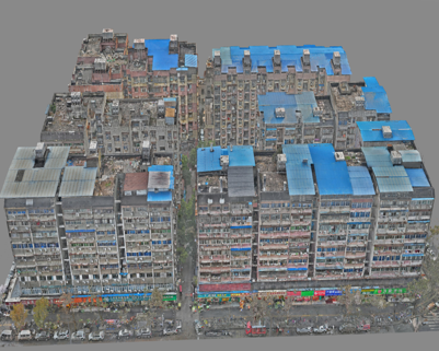
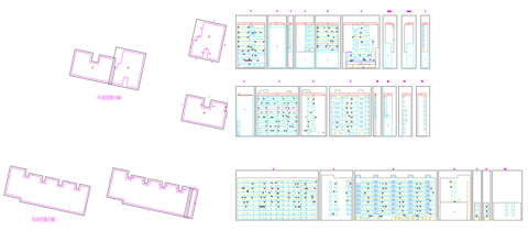
AI automatically compiles defect data, categorizing by building and defect type, generating defect summary tables and automatically drawing defect distribution maps, reducing manual compilation and drafting workload. Some AI tools automatically check vector data topology errors (such as overlapping features or gaps), alerting operators to make corrections.
(2) Results verification: Focus on 3 areas. Accuracy check: Use RTK to field-measure selected defect points (such as wall cracks, roof leak areas), comparing against deliverable coordinates and dimensions to confirm error is within 5 cm. Defect check: Review building by building, section by section, confirming no missed or misidentified defects and that severity ratings are accurate. Topology and attribute check: Ensure defect annotations correspond to building outlines and that attribute data (defect type, dimensions, severity) is complete, accurate, and properly coded. AI batch-verifies results, automatically comparing field-measured coordinates against deliverable coordinates and flagging points where error exceeds tolerance. AI also checks annotation completeness and accuracy, flagging missed or misidentified defects to assist human review and improve efficiency (manual review of one neighbourhood takes a full day; AI-assisted review takes 3 to 4 hours). For attribute data, AI automatically verifies coding and dimensions to prevent manual entry errors.
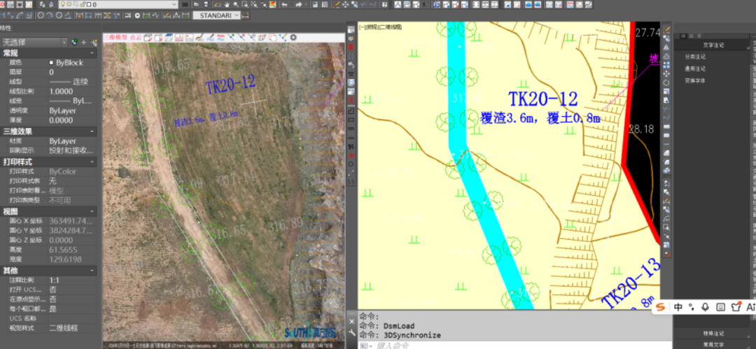
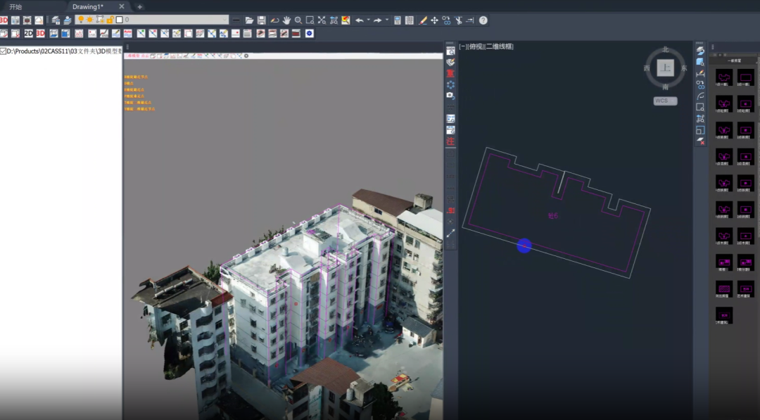
(3) Deliverable output: After verification, export the final products. Graphic deliverables: DWG vector maps, defect distribution maps, TIFF orthomosaics, 3D models. Report deliverables: Aging building defect survey report (including defect summary table, defect analysis, and repair recommendations), flight report, aerial triangulation report. Deliver to the urban renewal project owner and repair contractor. Back up all digital files for company records, providing data support for subsequent repair work and acceptance inspections.
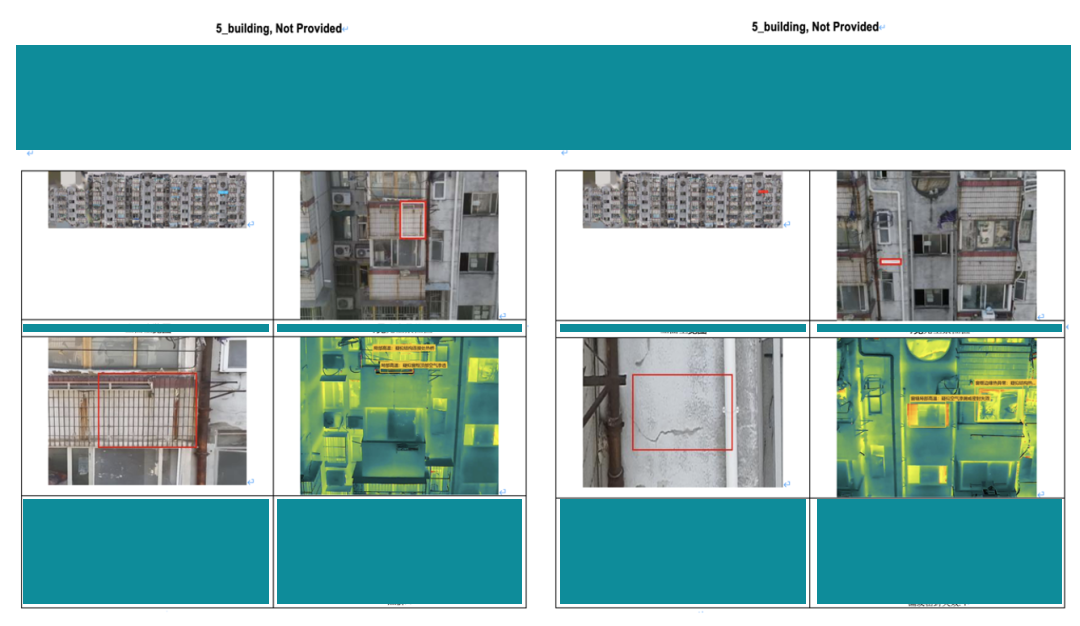
AI automatically generates defect survey report drafts, populating defect summary data and accuracy metrics. Human reviewers only need to add defect analysis and repair recommendations, significantly reducing report writing workload. Some AI tools can automatically adapt to different project owners' deliverable formats, quickly exporting required files and avoiding rework caused by format mismatches.
2. Recommended Hardware and Software
(1) Hardware: High-performance workstation (same as data processing, for deliverable editing and verification). Larger firms may deploy an AI verification server for improved batch checking efficiency.
(2) Software: AutoCAD (vector maps, defect distribution maps), ArcGIS (attribute editing, defect compilation, deliverable export), Adobe Acrobat (generating PDF defect survey reports), Microsoft Office (organizing defect summary tables and repair recommendations), Trimble Business Center (professional accuracy verification, suited to large urban renewal projects).
AI-assisted software: ArcGIS AI verification module (AI topology checks, accuracy verification), AI report generation tools (automated defect survey report drafting), AI deliverable verification systems (batch checking defect annotations and deliverable accuracy).
3. Important Notes
(1) Don't skip accuracy checks: Defect accuracy directly affects repair plan development. If errors are too large, repairs will be inadequate. Re-annotate and re-verify to ensure every defect's coordinates and dimensions are precise. AI verification is an aid only. Core accuracy must be confirmed through human field measurement.
(2) Match deliverable formats to project requirements: Urban renewal project owners and repair contractors may require different file formats. Confirm requirements in advance to avoid rework after export. Defect survey reports must be thorough and complete, including defect analysis and repair recommendations to support project decision-making. Always carefully edit and supplement AI-generated report drafts to meet specific project needs.
(3) Keep defect summaries clear: Organize by building and by defect type so project owners can quickly understand each building's condition and develop tailored repair plans. Avoid jumbled defect data. After AI compilation, manually verify all figures to catch any statistical errors.
Current Technical Challenges: Drone + AI for Aging Building Defect Inspection
Based on real-world experience with aging building defect surveys in urban renewal projects, the combination of drone surveying and AI significantly improves efficiency and reduces labour costs. However, several technical pain points remain, mainly around "AI detection accuracy, adaptation to complex environments, and deliverable practicality." These are the areas the industry most needs to advance:
1. Insufficient Accuracy for Fine Defect Detection, with Notable Missed and False Identifications
For fine defects in aging buildings (such as wall cracks 1 mm or narrower, subtle roof leak stains, localized surface powdering), AI detection accuracy varies depending on flight altitude, lighting conditions, and camera quality. On one hand, AI struggles to consistently capture fine defect details, leading to missed identifications. On the other hand, wall stains, scratches, and fine cracks can look similar in imagery and 3D models, causing AI false positives. Significant manual review is still required.
Current mainstream AI defect annotation tools achieve 85%+ accuracy for cracks 2 mm or wider, but only 50% to 60% accuracy for cracks 1 mm or smaller. Different lighting conditions (overcast vs. bright sun) and different building materials (such as aged brick vs. painted surfaces) further affect AI accuracy and increase false positive rates.
2. Poor AI Adaptation to Complex Older Neighbourhood Environments
Older neighbourhoods commonly have "tightly packed buildings, narrow gaps, messy wiring, and dense tree canopy." AI flight planning and obstacle identification tools can misclassify items (such as flagging balcony clutter or small branches as major obstructions), leading to suboptimal flight paths and missed defect areas. Additionally, shadow zones between buildings and wire-obstructed areas produce blurry imagery that AI cannot reliably analyze, still requiring manual supplementary capture and review.
AI models are largely trained on standard environments and do not adapt well to the complex conditions of older neighbourhoods, especially dense multi-building sites with tangled wiring. AI obstacle warnings and defect detection accuracy drop significantly in these scenarios. Some aging buildings have severely deteriorated surfaces with inconsistent materials, which AI struggles to quickly adapt to, requiring manual parameter adjustment or custom model training, adding operational costs.
3. Data Processing Efficiency Bottlenecks and High Hardware Costs
While AI improves processing efficiency, for large older neighbourhoods (many buildings, massive photo volumes), AI modelling and annotation still require considerable time (a large neighbourhood may take 3 to 5 days for AI processing). Running AI software demands high-end hardware, and the cost of high-performance workstations and dedicated AI servers is prohibitive for small and mid-sized firms, limiting AI adoption.
Some AI tools suffer from "algorithm bloat", consuming excessive memory during processing and causing system slowdowns. Data interoperability between different AI tools is also limited (for example, AI annotation data may not import directly into standard modelling software), requiring manual conversion that impacts overall efficiency.
4. Limited AI Integration with Other Data Sources, Reducing Deliverable Practicality
Currently, aging building defect data captured by drone + AI (coordinates, dimensions, types) largely exists in isolation, with limited ability to integrate with other urban renewal project data (such as property records, previous repair histories, geotechnical survey data). AI cannot combine these sources for root-cause analysis, so deliverables often remain at the "defect annotation" level. AI-generated repair recommendations tend to be generic and lack specificity, making them difficult to directly support repair construction. Deliverable practicality needs improvement.
5. Custom AI Model Development is Difficult and Expensive
Different older neighbourhoods have significantly different building structures and defect characteristics (for example, heritage brick buildings from the early 1900s have different defect patterns than 1970s concrete apartment blocks). General-purpose AI models cannot achieve sufficient accuracy across all scenarios. Custom AI models (tailored to a specific neighbourhood or defect type) require large volumes of annotated training data and specialized technicians to configure, making them expensive. This cost is difficult for small and mid-sized firms to justify, limiting the flexibility of AI deployment.
SkyFlow supplies enterprise drones, sensors, and training for inspection teams across Canada. shop.skyflow.ca · skyflow.ca