Watch the complete tutorial
Turn the film into a training plan
| Mission need | Start with | Then add |
|---|---|---|
| Aircraft readiness | First Use; Linking and Controls | Firmware Update |
| Search and observation | Camera Features; Built-in AI | Airborne Relay; Pilot 2 Plugins |
| Shadowed inspection areas | Camera Features | AL2 Spotlight |
| Aerial communication | AS2 Speaker | Prepared recordings and warning-light effects |
| Vessel operations | Boat Launch | Camera Features; AS2 Speaker |
Start with the camera and sensing systems
The film first connects computing power with the camera system: a native 1K-class thermal sensor, real-time 2K UHR imaging, a full-colour wide view for low light and telephoto imaging with a switchable IR cut filter. Native thermal capture and the UHR imaging mode are distinct parts of that description.
For an operator, the useful sequence is context, detail and interpretation. Establish the subject in a wide view, examine it more closely, then relate its thermal pattern to recognizable physical features. The camera-features guide turns that idea into the exact split-screen, Night Scene and fusion controls in Pilot 2.
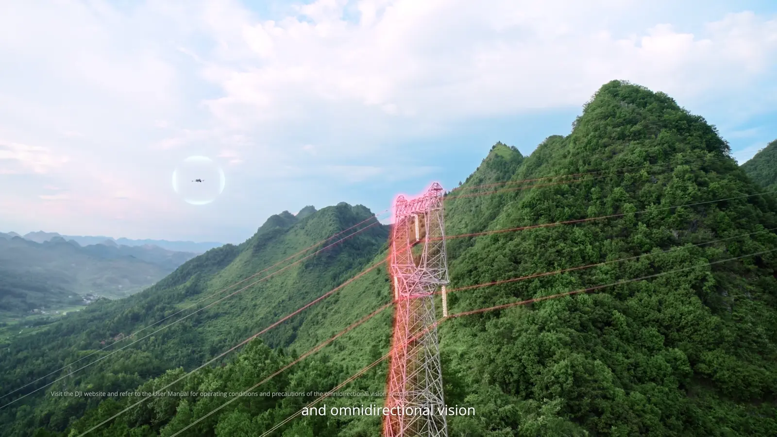
The sensing section combines LiDAR, millimetre-wave radar and omnidirectional vision. Use the source film to understand the system's role, then include the aircraft manual's operating conditions in the mission preparation.
Connect endurance, weather protection and AI to the mission
DJI introduces an IP55-rated, sealed multi-compartment housing, followed by manufacturer laboratory figures of up to 59 minutes of flight time and a top speed of 23 m/s. A crew plan should translate those product figures into the actual route, payload and recovery sequence it intends to fly.
The AI segment introduces detection of more than twenty target types and support for third-party models. The practical setup is more specific than the headline: choose a target category, configure confidence and alert conditions, and review the resulting observations. The built-in AI guide explains those controls for visible and infrared recognition.
- Define the task and the observation the crew needs to deliver.
- Choose the imaging and accessory configuration for that task.
- Include the return and landing sequence in the flight plan.
- Set recognition and notification conditions around a known target.
Follow the search-and-response workflow
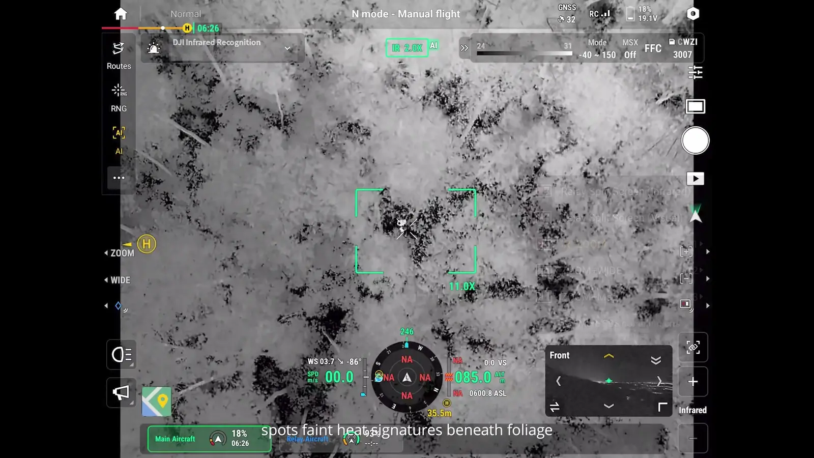
The search sequence brings several functions together: fast deployment, external routes through third-party Pilot 2 plugins, relay networking, thermal detection, split-screen confirmation and live information shared with ground teams. The point is the handoff from an aerial observation to a usable location and description for the people responding.
SkyFlow's suggested training exercise is to use a known practice subject and give each crew member a defined role. One operator maintains the flight and link, another reviews the observation, and the receiving team confirms that the information is sufficient to locate the subject.
- Prepare the aircraft using the first-use and linking guides.
- Configure the camera pairing and recognition task.
- Establish the relay network when the exercise calls for one.
- Confirm an observation with visible and thermal context before handing it to the ground team.
Apply the imaging workflow to power and bridge inspection
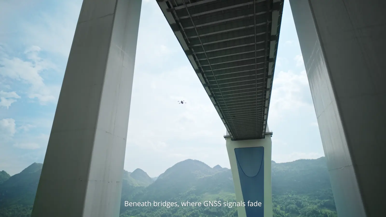
The infrastructure sequence shows detailed component photography, LiDAR-supported power-line work and LiDAR-vision fusion positioning beneath a bridge. It then demonstrates a spotlight following the camera into shadowed areas.
For an inspection record, preserve both the close detail and an overview that identifies where the detail belongs. A technically sharp image is more useful when the receiving engineer or asset team can locate the component and understand the viewing direction.
The AL2 tutorial covers installation, lighting modes, follow behaviour and calibration. Practise those steps on the ground before combining the spotlight with an inspection route.
Build a vessel-operation workflow
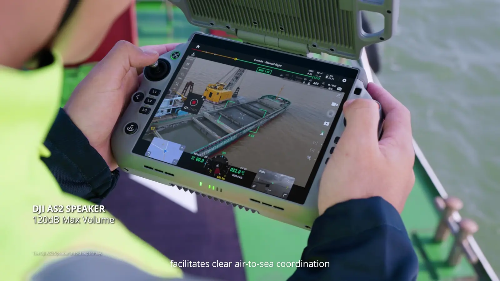
The maritime sequence combines vessel takeoff and landing, observation, zoom and speaker communication. It also names FlightHub 2's multimodal AI in its vessel-identification example; that demonstration is a connected software workflow, distinct from the onboard AI settings shown in the dedicated tutorial.
Boat Launch Mode adds a deck marker, heading alignment, continuous home-point updates and Landing Recognition. The dedicated boat guide follows these steps through automatic landing and a repeat attempt. The AS2 guide explains how to prepare a recording, preview it locally and broadcast it through the aircraft speaker.
- Brief the vessel and flight crews on the launch and recovery sequence.
- Prepare the landing marker and continuous home-point updates.
- Select the camera view for observation and identification.
- Prepare concise speaker messages before departure.
Understand thermal inspection and mapping output
The solar and structural inspection segment uses thermal imaging to reveal temperature patterns. The film then introduces TimeSync 2.0, DJI Terra rolling-shutter calibration, high-precision models and 2D radiometric maps.
Start an inspection or mapping plan with the deliverable: a component observation, a site overview, a model or a thermal map. That choice determines which views and records the team needs to collect and how the result will be reviewed. Keep capture settings and processing steps with the project record so another person can follow the workflow.
The product film introduces these capabilities; the camera tutorial provides the operator controls for the views used during collection, and the equipment page brings together the aircraft specifications and configuration options.

Choose a learning path for your crew
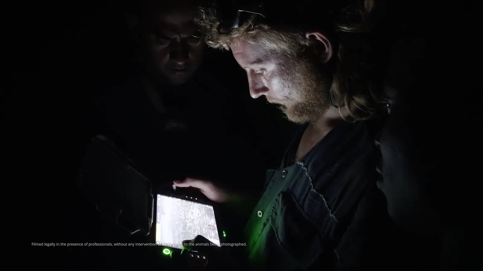
The final field sequence shows wildlife observation using low-noise flight and high-resolution thermal imaging. Across the film's different applications, the recurring workflow is consistent: locate the subject, obtain useful detail, retain context and communicate the result.
Use the learning series in stages. First establish aircraft preparation, linking and firmware maintenance. Add camera operation and AI next. Then introduce the accessories and advanced workflows required by the actual operation. That sequence helps each new capability sit on a familiar foundation.
- Start with First Use, Linking and Controls, and Firmware Update.
- Continue with Camera Features and Built-in AI.
- Add AL2, AS2, Boat Launch, Airborne Relay or Pilot 2 Plugins to match the mission.
- Finish a practice session by reviewing the collected information with the person who will use it.
Your session checklist
Use these points to review the workflow with your crew.
- Mission deliverable defined
- Aircraft and controller setup covered
- Camera and thermal workflow selected
- AI and connected-software roles distinguished
- Accessory setup matched to the operation
- Crew handoff and recovery sequence planned
Questions & answers
Where should a new Matrice 5T operator start?
Begin with First Use, Linking and Controls, and Firmware Update. Then learn the camera and AI workflows before adding accessories or advanced deployments.
Is 2K UHR the same as native thermal resolution?
The film describes a native 1K-class thermal sensor with a real-time 2K UHR imaging mode. These refer to native capture and an enhanced imaging mode respectively.
Does the product film’s vessel AI example use onboard recognition?
That sequence explicitly names FlightHub 2’s multimodal AI. The separate built-in AI tutorial covers the onboard visible-light and infrared recognition settings in DJI Pilot 2.
Video transcript
Read the complete transcript
Challenges take many forms in aerial operations.
To meet diverse demands, every capability matters.
The highly versatile compact flagship DJI Matrice 5T poised to answer the call.
Enhanced computing power unlocks the full potential of the camera system.
A native 1K thermal sensor featuring real-time 2K UHR imaging reveals subtle temperature differences.
The full-color wide camera reveals the scene in low light.
Then the telephoto zooms in while the IR cut filter can be toggled.
The new Intelligent Perception Suite navigates complex surroundings.
LiDAR, millimeter wave radar, and omnidirectional vision combine to deliver wire-level obstacle sensing.
Multi-compartment, fully sealed housing offers IP55 rated protection.
The aircraft keeps flying through rain and dust, so the mission won't stall.
High-capacity batteries provide up to 59 minutes of flight time.
A reinforced propulsion system increases top speed to 23 meters per second.
Powered by robust onboard computing, built-in AI detects over 20 target types in real time.
Third-party models are also supported for specialized target types.
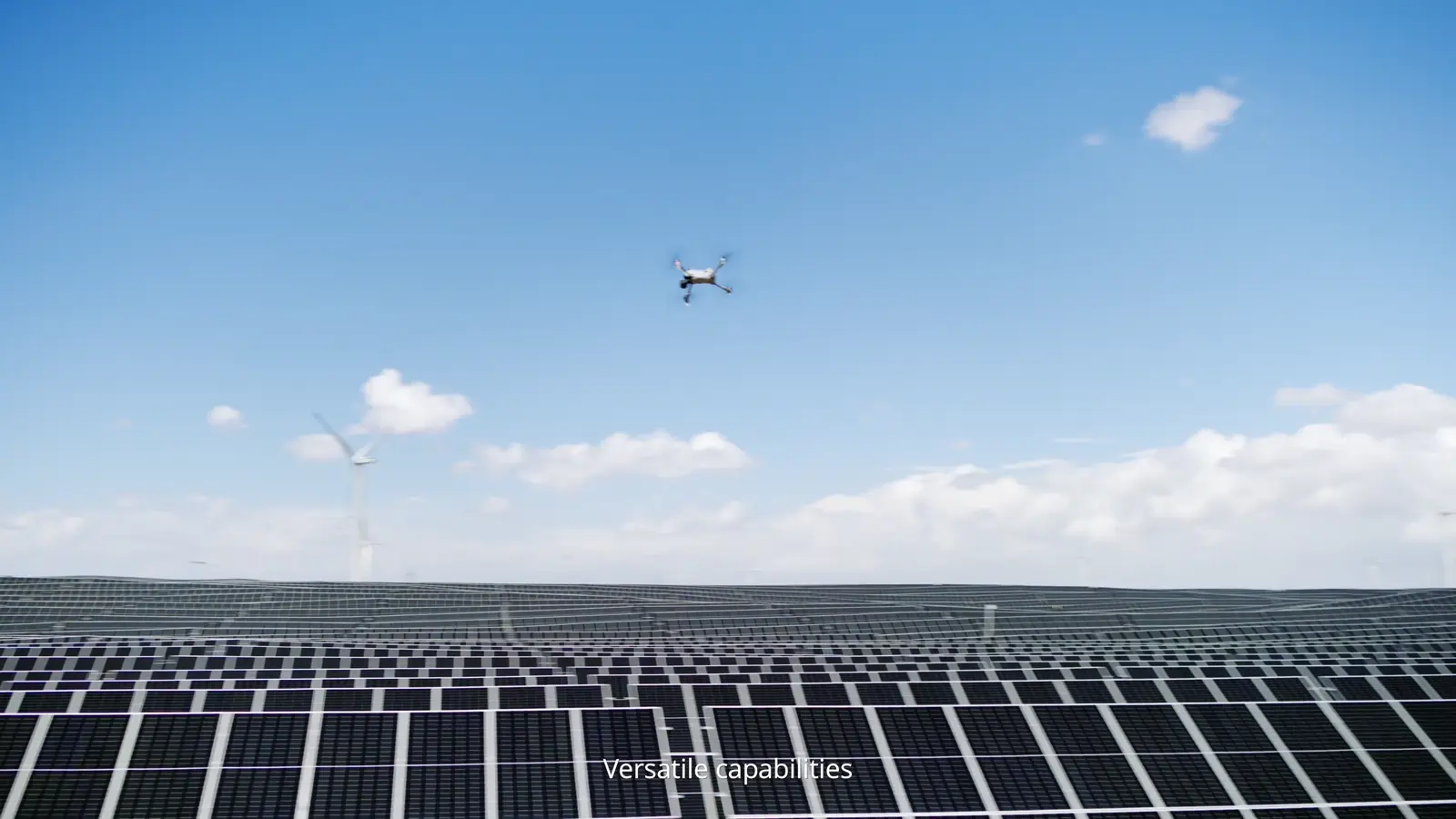
Versatile capabilities are engineered for critical missions across industries.
When lives are on the line, Matrice 5T rises to the challenge.
Airborne in 10 seconds.
Through third-party Pilot 2 plugins, external routes are seamlessly imported.
Paired with relay networking, large-scale search grids are rapidly deployed.
Amid dark forest canopies, LiDAR actively detects obstacles, enabling safe, close-range
searches.
1K thermal imaging spots faint heat signatures beneath foliage.
Simultaneous split-screen display helps confirm subjects.
Stream live data to ground teams,
guiding them straight to the scene.
Visual confirmed, rescue underway.
Over the power grid, the multi-camera system captures high-res photos of fine components,
while LiDAR accurately detects power lines,
Driving efficient, automated inspections.
Beneath bridges where GNSS signals fade, LiDAR Vision Fusion Positioning allows flight operations
to continue uninterrupted.
A synchronized spotlight follows the camera's view, illuminating shadowed areas.
During maritime patrols, Matrice 5T safely takes off from and lands on moving vessels.
Combined with FlightHub 2's multimodal AI, it identifies vessel types from hundreds of
meters away.
Then, up to 176 times hybrid zoom locks onto key details.
A high-volume speaker facilitates clear air-to-sea coordination.
For solar and structural inspections, 1K thermal camera reveals subtle hotspots, four times
the resolution of 640 boosts inspection efficiency.
And with the new sub-2G frequency, signal range extends up to 40 kilometers.
TimeSync 2.0 delivers microsecond-level synchronization, and Terra's rolling shutter calibration generates
high-precision models and 2D radiometric maps.
In wildlife conservation,
low-noise flight and high-resolution thermal imaging
quickly detects nocturnal animal movements
and clearly capture activity details
without disturbing wildlife.
This is DJI Matrice 5T.
Inspect more closely with advanced sensing.
Connect farther with robust transmission
Cover more with extended endurance and respond faster with onboard AI.
Always in its element.
Advancing spatial intelligence across industries.