EVO Lite 640T Enterprise · SE V2 controller · v1.0.2
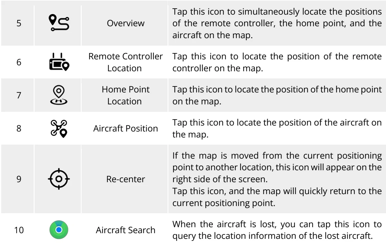
In dual screen mode, tap the illustrated icon at the corner of the “Map" dual screen; or after entering the "Wide Angle" camera interface or “IR” camera interface, tap the “Map" mini window at the lower left corner to enter the "Map" full-screen interface. PDF p. 115
Original instruction with its control symbol

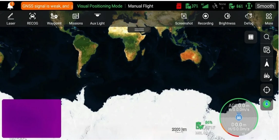
| No. | Icon Name | Description |
| 1 | Search Map | When the remote controller is connected to the Internet, tap this icon and enter the desired location name in the "Search Map" edit box. Based on the selected location, the map interface will switch to display the map of the corresponding location. Tap this icon to adjust the map display style to a standard map or a hybrid map, as well as to set "Display/Clear Flight Path" and import GEO-fence. It |
| 2 | Map Management | also supports offline map download and management. Standard: 2D map. Hybrid: 2D map and satellite map combined. This icon indicates that the display direction of the map is locked. |
| 3 | Orientation Lock | When the remote controller is rotated, the display direction of the map will not change accordingly. Tap this icon to unlock the display direction of the map of the current remote controller. This icon indicates that the display direction of the map is unlocked. |
| 4 | Orientation Unlock | When the remote controller is rotated, the display direction of the map will change accordingly. Tap this icon to lock the display direction of the map of the current remote controller. |
View the original table / diagram
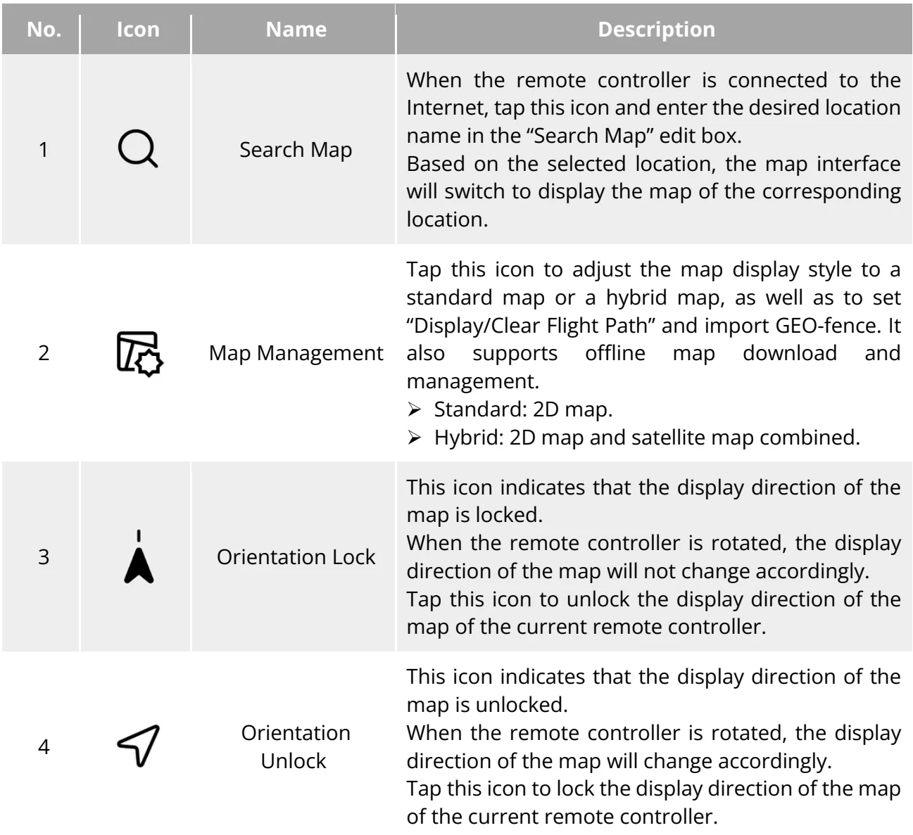
| 5 | Overview | Tap this icon to simultaneously locate the positions of the remote controller, the home point, and the aircraft on the map. | |
| 6 |  | Remote Controller Location | Tap this icon to locate the position of the remote controller on the map. |
| 7 | Home Point Location | Tap this icon to locate the position of the home point on the map. | |
| 8 | Aircraft Position | Tap this icon to locate the position of the aircraft on the map. | |
| 9 |  | Re-center | If the map is moved from the current positioning point to another location, this icon will appear on the right side of the screen.Tap this icon, and the map will quickly return to the current positioning point. |
| 10 |  | Aircraft Search | When the aircraft is lost, you can tap this icon to query the location information of the lost aircraft. |
View the original table / diagram